UN
108 Greenbank Road
£ 325,000
Description
We don't have a Description for this property.
- Bedrooms
- 2
- Bathrooms
- 0


Leaflet © OpenStreetMap contributors
The heatmap indicates the level of crime in the area. The color of the heatmap indicates the crime severity and recency.
Metrics Year-on-Year
- Average area value
- 343,763.00 £Increased by 1.29 %
- Average area rental value
- 1,560.00 £/moDecreased by 6.25 %
- Est rental Yield
- 5.45 %Decreased by 7.31 %
- Crime Rate
- 3.00 %Unchanged by 0.00 %
from 339,393.00 £
from 1,664.00 £/mo
from 5.88 %
from 3.00 %
Nearby Schools
| Name | Type | Ofsted | Distance |
|---|---|---|---|
| Whitehall Primary School | Community School | Outstanding | 0.37 KM |
| The Limes Nursery School | Local Authority Nursery School | Good | 0.41 KM |
| The Limes Nursery School & Children'S Centre | Children's Centre | 0.44 KM | |
| May Park Primary School | Academy Sponsor Led | 0.48 KM | |
| The City Academy Bristol | Academy Sponsor Led | Good | 1.13 KM |
Images
Nearby Streets
| Name | Average Price | Average Sqft | Distance |
|---|---|---|---|
| Packers Way | £ 635,000 | 0 | 0.00 KM |
| Kingsley Road | £ 250,000 | 0 | 0.00 KM |
| Shaw Road | £ 430,000 | 0 | 0.00 KM |
| Gordon Road | £ 380,000 | 0 | 0.00 KM |
| Ida Road | £ 250,000 | 0 | 0.00 KM |
Nearby Transport
| Name | NLC | TLC | Distance |
|---|---|---|---|
| Stapleton Road | 3250 | SRD | 1.24 KM |
| Lawrence Hill | 3225 | LWH | 1.52 KM |
| Bristol Temple Meads | 3231 | BRI | 3.58 KM |
| Montpelier | 3203 | MTP | 3.72 KM |
| Filton Abbey Wood | 3235 | FIT | 4.18 KM |
Nearby Listings
| Address | Price | Type | Score | Distance |
|---|---|---|---|---|
| Greenbank Road, Greenbank, Bristol | £ 425,000 | BUY | 6 / 10 | 0.07 KM |
| Majestic Heights, Co-operation Road | £ 350,000 | BUY | 6 / 10 | 0.10 KM |
| Majestic Heights, Co-operation Road | £ 259,000 | BUY | 5 / 10 | 0.10 KM |
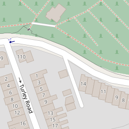
| Turley Road, Greenbank, Bristol BS5 6HP | £ 375,000 | BUY | 5 / 10 | 0.14 KM |
| The Chocolate Factory, Greenbank | £ 300,000 | BUY | Unknown | 0.17 KM |
Nearby Properties
| Address | Price | Distance |
|---|---|---|
| 90 Greenbank Road | £ 395,000 | 0.00 KM |
| 111 Greenbank Road | £ 300,520 | 0.00 KM |
| 102 Greenbank Road | £ 300,000 | 0.00 KM |
| 104 Greenbank Road | £ 297,000 | 0.00 KM |
| 108 Greenbank Road | £ 325,000 | 0.00 KM |